
Land Survey & BPN Boundary Verification in Bali
Why foreign buyers must verify land boundaries in Bali. Learn how land surveys and BPN checks prevent costly disputes, size mismatches, and legal risks before buying property.
Fresh Leaf Consulting — Bali Real Estate Advisory & Due Diligence
1/2/20263 min read
Land Survey & BPN Boundary Verification in Bali
Why Foreign Buyers Must Do This Before Buying Property
Buying land or a villa in Bali can be highly rewarding — but it carries unique legal risks that many foreign buyers underestimate. One of the most common and costly mistakes is skipping a professional land survey and boundary verification with BPN before committing to a purchase.
In rapidly developing areas such as Canggu, Uluwatu, and Pererenan, boundary disputes, measurement errors, and outdated land certificates are far more common than most buyers expect. These issues often surface after payment, when legal remedies are slow, expensive, or impossible.
This article explains why land surveys and BPN verification are non-negotiable, how the process works, and how foreign buyers can protect themselves.
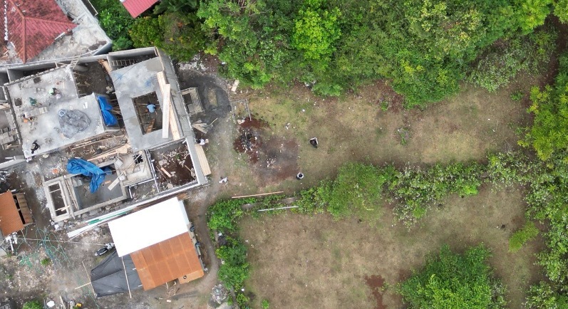
What Is a Land Survey in Bali?
A land survey is a physical, on-site measurement of the land conducted by a licensed surveyor, confirming:
Actual land size (square meters)
Exact boundary lines
Boundary markers (patok)
Alignment with neighboring plots
In Bali, many land certificates were issued decades ago, using manual measurements or outdated reference points. As a result, the physical land on the ground often does not match the certificate.
Why BPN Boundary Verification Is Critical
Indonesian National Land Agency (BPN – Badan Pertanahan Nasional) is the only authority that officially records and recognizes land ownership, boundaries, and zoning.
A BPN boundary check confirms:
The land certificate is valid and registered
The registered boundaries match the physical land
There are no overlapping claims
The plot does not encroach on neighboring land or public land
⚠️ Important:
A notary check alone does not guarantee physical boundary accuracy. Without a survey + BPN confirmation, you are relying on paperwork that may be wrong.
Common Risk #1: Land Measurement vs Certificate Mismatch
One of the most frequent problems foreign buyers face is buying less land than they think.
Typical scenarios:
Certificate states 500 m², actual land measures 460 m²
Boundary markers shifted over time
Part of the land overlaps with a neighbor’s plot
Access road cuts into the registered area
Who bears the loss?
Almost always the buyer.
Once a sale is completed, recovering value is extremely difficult, especially if the seller claims good faith.
Common Risk #2: “BPN Check” Misunderstood
Many buyers are told:
“The land is already checked with BPN.”
What this often means:
Only the certificate number was verified
No physical measurement was done
No boundary confirmation with neighbors
No updated survey registered with BPN
A proper BPN process should include:
Physical land survey
Boundary confirmation (often involving neighbors)
Alignment with BPN records
Official acknowledgment of findings
Anything less is partial due diligence.
Boundary Dispute Cases (illustrative examples)
These kind of cases are real and common:
Case 1 – Canggu
A foreign buyer purchased land for a villa project. After construction began, a neighbor filed a claim stating the boundary wall encroached by 1.2 meters. Construction stopped for 7 months while the dispute was resolved. Legal and delay costs exceeded USD 40,000.
Case 2 – Uluwatu
Land certificate showed sea-view frontage. After survey, part of the land was identified as protected setback zone, reducing buildable area by 18%. The buyer had already paid the full price.
Case 3 – Pererenan
Two adjacent plots shared unclear boundary markers. Both owners had valid certificates. Resolution required court mediation and re-survey — costly and time-consuming.
According to BPN, land boundary discrepancies and overlapping certificates remain a recurring issue, particularly in high-growth areas.
BPN land registration procedures
Agrarian Law (UUPA)
Public BPN statements on land disputes
All of these cases could have been avoided with a proper land survey and BPN verification before signing.
Why This Matters Even More for Foreign Buyers
Foreign buyers face additional challenges:
Cannot hold Hak Milik directly
Often buy via Leasehold, Hak Pakai, or PT PMA
Limited legal leverage after completion
Language and system barriers
Because of this, preventive due diligence is far more effective than legal action later.
Professional investors treat land surveys as mandatory, not optional.
Best Practice: What We Recommend at Bali Fresh Leaf
Before any commitment:
Independent land survey by a licensed surveyor
Boundary verification aligned with BPN records
Zoning and setback confirmation
Cross-check with notary findings
Clear written confirmation before deposit or final payment
This approach reduces:
Legal risk
Construction surprises
Resale problems
Long-term disputes
Credible References & Sources
Indonesian National Land Agency (BPN) — official land registration and boundary authority
KPMG Indonesia — property, land compliance, and foreign investment guidance
Indonesian Agrarian Law (UUPA)
Local notary and land office procedures
Final Thought
In Bali real estate, what you see on paper is not always what exists on the ground.
A land survey and BPN boundary verification are not bureaucratic extras — they are core risk-management tools. For foreign buyers, they often make the difference between a secure investment and a long-term legal headache.
At Bali Fresh Leaf, we believe legal clarity comes before location or price — always.